HRSC Subsurface Imaging

ezgif.com-webp-to-jpg-6

Optimize Your Investigative Phase

Eagle Synergistic Optimizing Technologies, LLC looks forward to assisting you in optimizing your investigative phase. Using advanced HRSC (high resolution site characterization), we perform environmental site assessments by using the latest and most proven tools and technologies.

Our versatile and dynamic team brings over 30 years of experience to the table. We've worked extensively in subsurface imaging, logging, sampling, consulting, 3D modeling, geology, hydrogeology, and geophysics.

HRSC Tools and Technologies

  • MIP: Membrane Interface Probe
  • LL-MIP: Low-Level MIP
  • MIHPT: Combined MIP & HPT
  • OIP: Optical Imaging Profiler
  • OIHPT: Combined OIP & HPT
  • OIHPT-G: OIHPT-Green
  • NMR: Nuclear Magnetic Resonance
  • Discrete GWS / Profiler
MIHPT

MIP

Membrane Interface Probe – The MIP is a logging tool that measures volatile hydrocarbon and solvent contamination along with soil electrical conductance and permeability. It then shows distribution and relative magnitude of both halogenated and non-halogenated VOC contaminants to work with both saturated and unsaturated soils.

An inert carrier gas is continually swept behind a heated membrane in the probe, delivering it to a series of detectors at the surface. The detectors each respond to different analyte properties which allows the MIP operator to discern the contaminant to its family group as well as provide the ability to map out the contaminant plume from source to extent. Obtaining an understanding of soil conductance and permeability along with the contaminant information allows the user to know if the VOC contamination is near to prominent migration pathways or bound up in a storage zone.

The MIP is the only tool capable of logging VOCs on-site in real-time. It determines contaminant mobility and migration pathways, detects contaminants in both coarse and fine-grained soils and generates real-time contaminant screening information. This feature allows field adjustment of the site investigation.

LL-MIP

Low Level Membrane Interface Probe — The LL-MIP operates in a similar manner to our normal MIP tool, however, the LL-MIP enhances detector sensitivity by a factor of approximately 10. LL-MIP operation is beneficial in situations where the standard MIP detector signals have reached practical limits.

The main feature of this technology is to pulse the carrier gas stream that sweeps the internal surface of the MIP membrane. VOC contaminant concentration that is delivered to the MIP detectors is then increased.
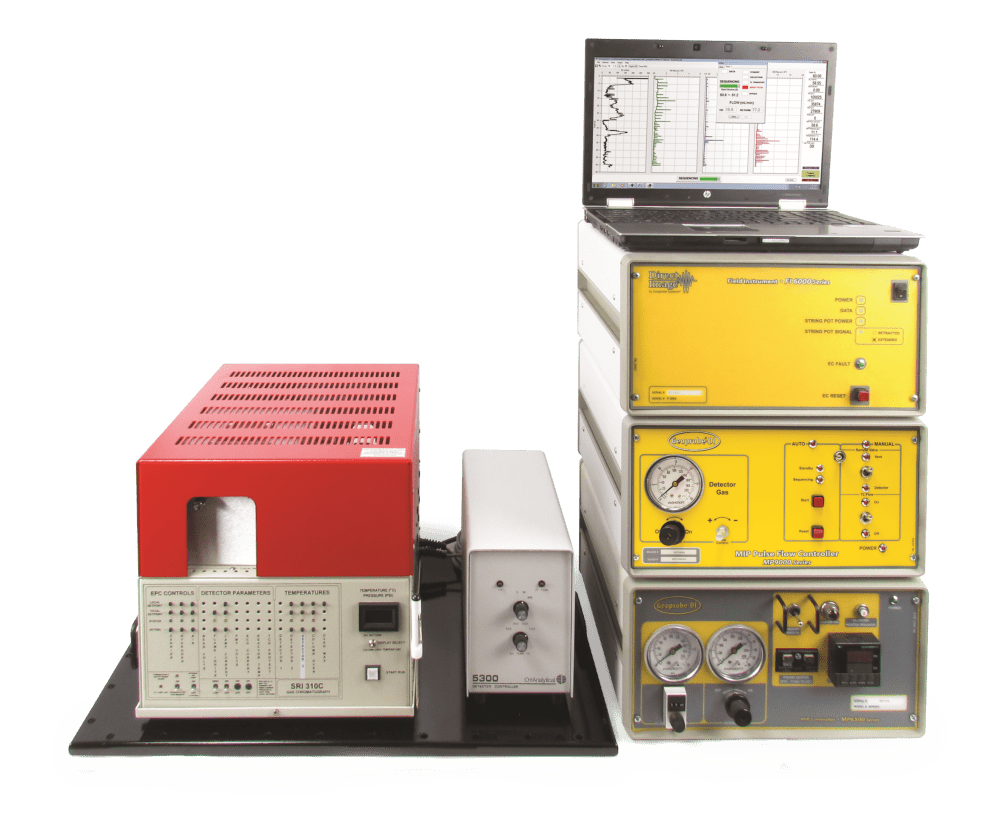
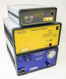
Surface instrumentation tools for high resolution site characterization.
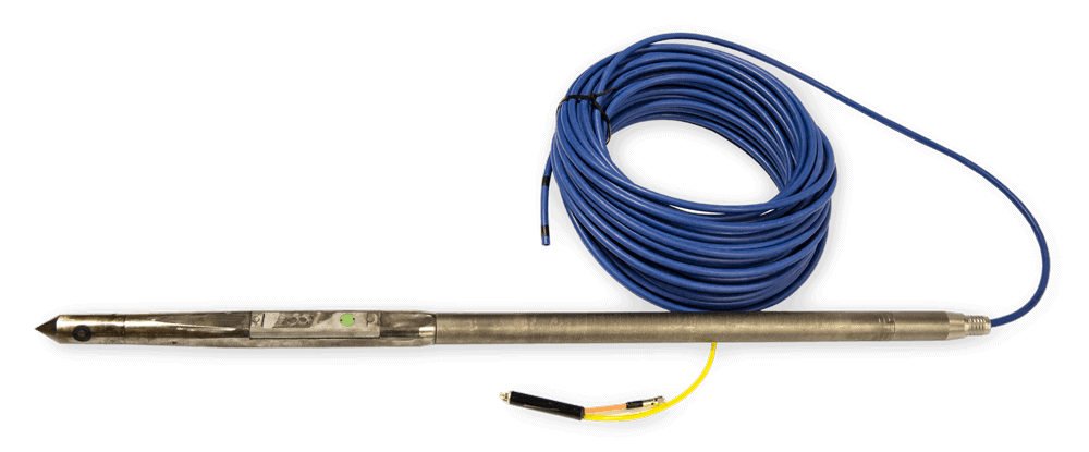
Geoprobe MIHPT probe

MIHPT

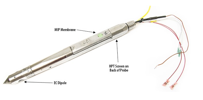
Membrane Interface & Hydraulic Profiling Tool – The MIHPT probe is a specialized, combined tool used to detect and determine volatile organic compounds (VOCs), soil permeability, and soil type/lithology all in one push. Volatile compounds diffuse through the MIP Membrane and a carrier gas transports the VOCs “up-hole” to detectors on the surface. The HPT system monitors the necessary pressure to maintain a constant injection. We can measure accurate water level data and estimate hydraulic conductivity from this information. Lastly, the Electrical Conductivity Dipole Array emits a current through the subsurface formation in between the two probe contacts. This current and the resulting voltage is measured and soil type can be determined by its conductivity.

OIP

Optical Image Profiler - This tool produces a detailed log of induced fuel fluorescence. It contains a downhole camera that operates at 30 frames per second (fps) to capture fuel fluorescence. Our acquisition software will then analyze each image for typical fuel fluorescence color.

The results are the percent of the image area (up to 100%) that displays fuel fluorescence. Fluorescence images are saved in the log every 0.05ft (15mm) for review at a later time.

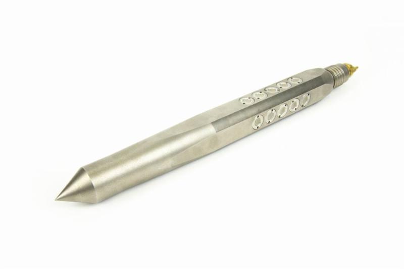
OIP log Interpretation is intuitive, made simple by the saved images to compare to the log. The OIHPT-UV probe contains both 275nm UV and visible LEDs. The OIHPT-G probe contains both 520nm LD and infrared LEDs. With this tool, we're able to automatically and manually capture visible soil images.
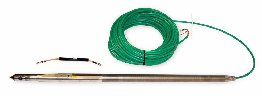
Geoprobe OIHPT Probe
Surface instrumentation tools for high resolution site characterization.

OIHPT

Optical Image Profiler & Hydraulic Profiling Tool – The OIHPT is a specialized, combined tool that allows us to detect LNAPL products, test soil permeability, and understand soil type/lithology before your remediation phase. Rather than a MIP Membrane, the OIHPT tool has an OIP Window used to detect UV induced fluorescence of LNAPL products in soil (petroleum hydrocarbons).

This equipment can be divided into two basic categories: surface instrumentation (OIP interface, data acquisition, and HPT controller) and downhole probes (including probes, trunklines, connectors, etc.)

  • OP6100 OIP Interface: This instrument regulates, controls and monitors power to the OIP power supply and sends the system control signals to the downhole tools.  Images from the down hole camera are collected by the instrument and relayed to the computer via a USB connection.
  • FI6000: Data acquisition instrument, acquires depth, EC, and HPT data if avilable and relays it to the computer via a USB connection. The FI6000 is the general data acquisition instrument used in all Geoprobe® DI logging systems (EC and HPT). It also provides the electrical conductivity measurement system associated with OIP.
  • K6300 Series HPT Controller (Optional): This instrument regulates and measures injection water flow and pressure to the OIHPT probe. Data from this controller is sent to the FI6000 via a data cable.
Geoprobe OIHPT Probe

OIHPT-G

Green light OIP tool — This tool operates in a similar manner to the OIHPT & OIP tools; however, it also uses a green laser diode to induce fluorescence in contaminants such as Creosote, Coal Tars, Heavy Crude Oils, and Bunker Fuels. This helps to fluoresce common organic contaminants that yield inconsistent results with standard UV light (coal tars, creosote, bunker fuels).
Screenshot 2024-02-06 102133

Nuclear Magnetic Resonance (NMR)

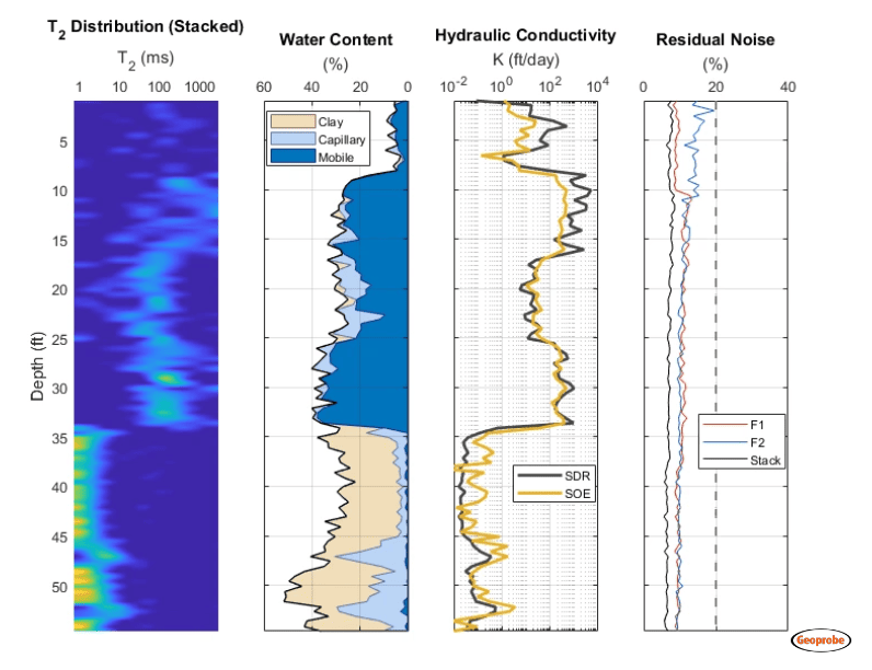
The NMR (nuclear magnetic resonance) is a direct push logging tool used to measure aquifer characteristics such as water content, porosity, and relative pore sizeThe tool uses powerful magnetic fields to affect the hydrogen nucleus of the water molecules causing them to generate an electromagnetic signal for direct characterizationThe magnitude of the initial signal is directly proportional to the amount of water within the pore space and the signal decay rate is strongly influenced by the pore size of the formationThis can be used to estimate critical properties governing flow and storage of groundwater, such as aquifer porosity and permeability in fully saturated formations. Additionally, this information can be used for calculations of contaminate mass flux and geotechnical bulk density loading.

One of the newest HRSC tools, the Groundwater Sampler (GWS), allows us to take multiple discrete groundwater samples at various depths.

Discrete Groundwater Sampler / Profiler (GWS)

The Ground Water Sampler (GWS) utilizes a 1.75” probe head and rods. Another option for the GWS tool is a 2.25” probe head and rods. The larger diameter tool has a downhole pressure transducer and an EC dipole for hydrological and lithological profiling. The probes are fitted with 20 HPT screens and an approximately 100 mL volume chamber. Attached to the end of the probe there is a DI supply line, which provides a consistent supply of DI water while the probe is advancing, and a mechanical bladder pump attached to a sample line that will pump ground water to the surface. As the tool is advanced through the subsurface the consistent supply of DI water being pumped down hole through a pressure transducer allows us to collect valuable HPT data as well discrete groundwater samples.

HRSC Subsurface Imaging Data

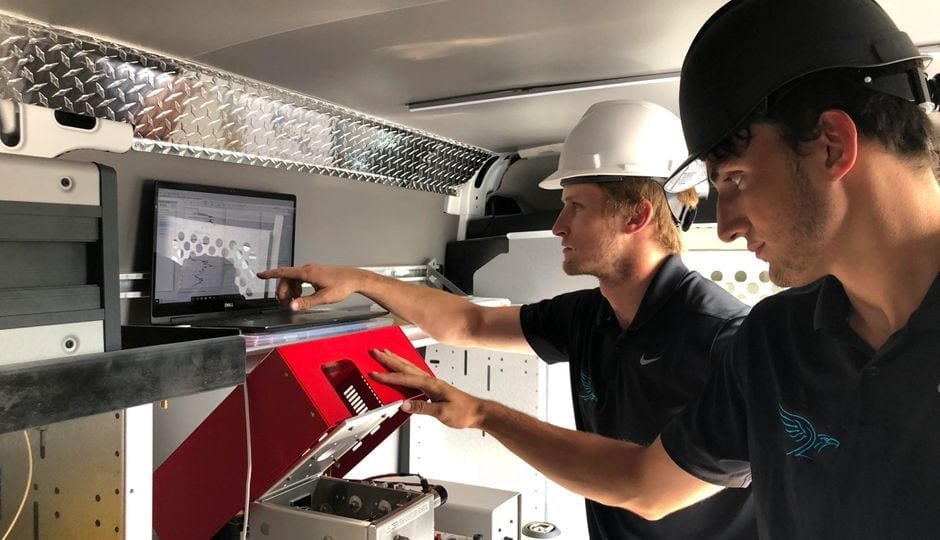
Utilizing our subsurface imaging logging tools & detectors, Eagle Synergistic can assist you with optimizing your investigative phase with live log data, indicating properties such as: soil type, permeability, conductivity, contamination, and more. You can receive this data live on-site or virtually in your office. Our experienced team will assist you with the data and mapping the extent of the contamination in the subsurface.

Ready to find out more?

Drop us a line today to get started!